Kirishima Geopark is an area centered on the Kirishima Mountains, which is a group of more than 20 active volcanoes lying on top of each other. Other than the Kirishima Mountains, there are also a variety of volcanic landforms to visit in the surrounding area, including multiple calderas and Shirasu plateaus.
Volcanic activities not only create landforms, but also various natural environments and ecosystems, and blessings such as hot springs and spring water.
Volcanoes have also influenced lifestyle and culture at the foot of the mountains. The influence of volcanoes can be seen in the stone culture and belief in volcanoes (shrines, etc.) that remain in various areas, as well as in the food culture of the region, including local specialties such as imo-jochu (sweet potato shochu) and tea.
A place where you can think about “what is a volcano” and experience the way of life and the culture of people who have lived at the foot of an active volcano, that is what Kirishima Geopark.
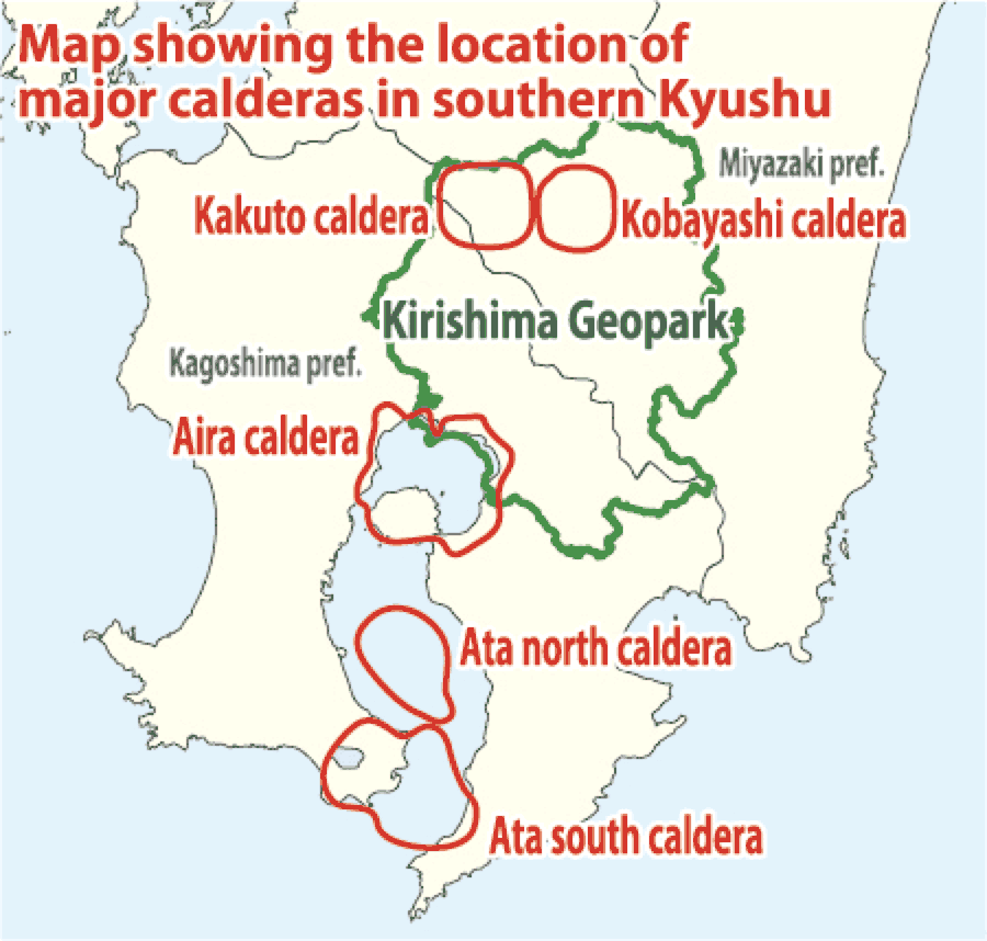
Caldera
A landform formed during an eruption, when a large amount of magma that had accumulated underground erupted all at once, causing the ground to plunge and sink into the hollowed-out beneath. A caldera eruption is a massive eruption of a magnitude such that once it occurs, it can destroy the surrounding civilization, and such eruptions occur once every few tens of thousands of years in Southern Kyushu.
Shirasu
The accumulation of large pyroclastic flows (a phenomenon in which volcanic ash, pumice, hot gasses, etc. flow in unison) that erupted during caldera eruptions. Shirasu is a folk name in Southern Kyushu and generally refers to the Ito Pyroclastic Flow deposit that erupted from the Aira Caldera about 30,000 years ago. A Shirasu plateau is the landform formed after a pyroclastic flow deposit that filled plains and valleys has been eroded.
People’s Lives Brought About by Shirasu
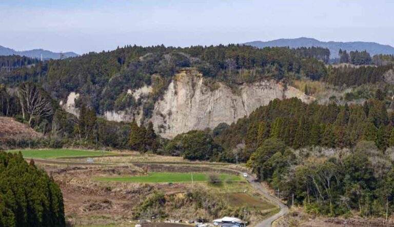
Cliff formed by Ito Pyroclastic Flow deposit (Miyakonojo City)
The Miyakonojo Basin, which was once a lake, was buried by pyroclastic flows (Shirasu) that erupted from the Aira Caldera to the south about 30,000 years ago and became land, and the Shirasu plateau was subsequently formed in the surrounding area.
Because Shirasu is easily permeable to water, crops such as sweet potatoes, which do not require much water, are still grown on the plateau to this day. On the other hand, water soaked into Shirasu is stored underground in the basin as abundant groundwater, and it’s used for local industries such as imo-jochu (sweet potato shochu) production.
In addition, the steep cliffs created by Shirasu plateaus are natural fortresses, and before the Edo Period, many mountain castles were built around this area to take advantage of the terrain.
Now and in the past, the people of this region have successfully incorporated Shirasu into their daily lives.
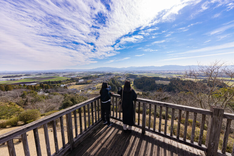
Mochio Shrine
The shrine is located on a high plateau made of volcanic rocks about 1.3 million years old, which is older than the Kirishima Mountains. From the observatory, visitors can enjoy a panoramic view of the Miyakonojo Basin, where a lake once spread out.
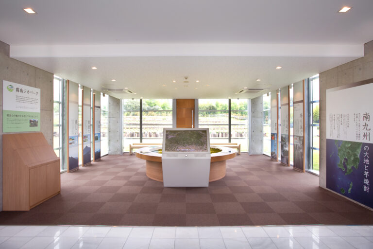
Kirinokura Museum
A facility for providing information about imo-jochu (sweet potato shochu) located on the grounds of the Kirishima Shuzo factory. The relationship between imo-jochu and the formation of the earth is explained in simple terms.
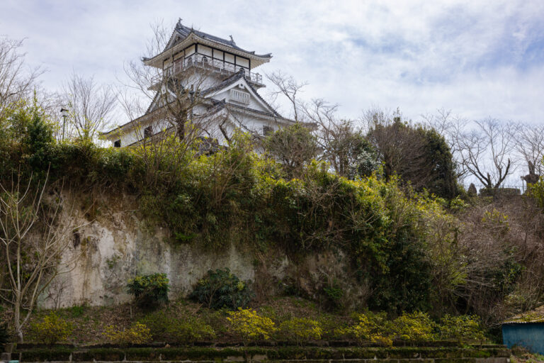
Ruins of Gassan-Hiwa Castle
Also known as “Takajo,” it is a mountain fortress consisting of seven Kuruwas (rings of walls) built on the edge of the Shirasu Plateau. It is believed to have been built in the Warring States Period, and as a stronghold in the northern part of the Miyakonojo Basin, many battles took place here.
_都城市提供-768x512.jpg)
Kannonze Waterway
A channel dug into the riverbed created by rocks (ignimbrite) that melted and hardened immediately after the accumulation of Shirasu. Constructions were carried out during the Edo and Meiji Periods respectively, which created the waterway’s current form. Until the development of land transportation, it played an important role in connecting the route between Miyazaki and Miyakonojo, where the steep slope made it difficult for ships to come and go.